CR55
| CCC Camp Road |
Power Line Cuts |
Old Flagg Trailhead |
Clearings Around Cabins |
Pinhoti Trail Northbound |
Weogufka Creek |
|---|
|
Tower / Pinhoti Parking |
|---|

| Flagg Mountain Trail System |
Old Pinhoti Terminus |
Weogufka Creek |
|---|
This page discusses facilities located at the Pinhoti Southern Picnic Pavilion Terminus. They are located in the center of the bottom of the map below, labeled Old Pinhoti Terminus, except that the logbook podium is a few minutes north along the purple trail, before the Y, and at the Y is the sign discussed last.
| Below: Flagg Mountain Trail System | ||||||||
|---|---|---|---|---|---|---|---|---|
| ↖ To CR55 |
|
|||||||
|

| |||||||
|
||||||||
| Above: Flagg Mountain Trail System | ||||||||
|
This page discusses facilities located at the Pinhoti Southern Picnic Pavilion Terminus. They are located in the center of the bottom of the map above, labeled Old Pinhoti Terminus, except that the logbook podium is a few minutes north along the purple trail, before the Y, and at the Y is the sign discussed last. This trailhead was built after the Flagg Northwest Trailhead, when Alabama Forever Wild acquired lands to build the Pinhoti north of here to Weogufka. This and the Flagg Northwest Trailheads are open regardless of whether a caretaker is present. Later, the top of Flagg Mountain was promoted as a trailhead and Pinhoti Southern Terminus. The cabin and tower areas are closed, and a hiker is trespassing in the cabin and tower areas, if a caretaker is not present atop the mountain per Alabama Forestry Commision rules. The care taker role has been taken by various AHTS persons (mostly Nimblewill Nomad), generally in daylight hours, since ??, except March through July 2020, due to COVID-19 quarantine issues. It appears this Pavilion Trailhead, and the Northwest Trailhead, may always provide backup trailhead locations to the Top of Flagg Mountain when that is closed for any reason. |
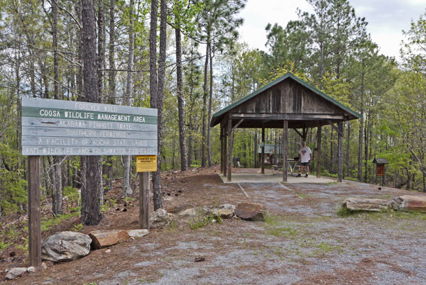 Pinhoti Southern Picnic Pavilion Terminus Photo taken by Dan Bedore 30 March 2020. 32.972876°N, -86.347924°W |
| In the foreground is a gravel hardened parking area for several vehicles, delimited by the ring of boulders. The gap in the boulders and the lined path are also hardened with gravel for wheelchairs, etcetera. John Calhoun is at the picnic table. To his left, behind the pavilion, is a kiosk with windows containing paper maps and notices. Farther to his left, at the right in the picture, is a kiosk with varnished wood maps of the Eastern Continental Trail and the Trail of the Ancients. One version of the Pinhoti heads north from behind the Pavilion. See map above. All of the structures at this site were in good shape, and there was little litter, when I took these photos 30 March 2020. |
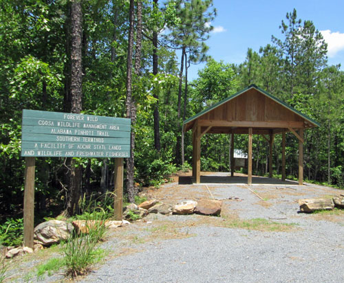
Pinhoti Trail Southern Terminus
Thursday, May 19, 2016
Photo by John Calhoun
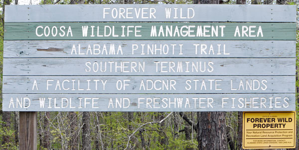 Coosa WMA Sign Photo taken by Dan Bedore 30 March 2020. |
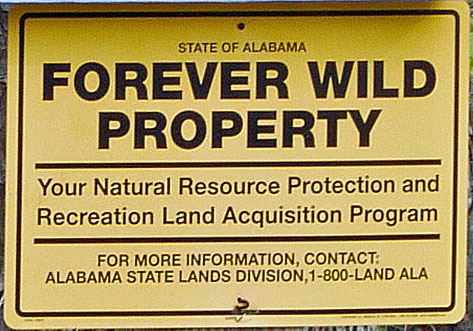 Coosa WMA Sign Photo taken by Dan Bedore 30 March 2020. |
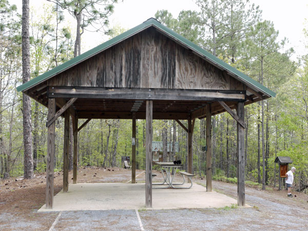 Picnic Pavilion Photo taken by Dan Bedore 30 March 2020. |
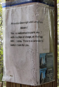 Flagg Parking and Hospitality Notice Photo taken by Dan Bedore 30 March 2020. |
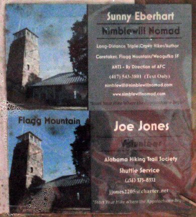 Detail of Cards Photo taken by Dan Bedore 30 March 2020. |
| Note condensed water & mildew even though the notice is in a sealed plastic bag and under the pavilion roof (back center post in photo above). | |
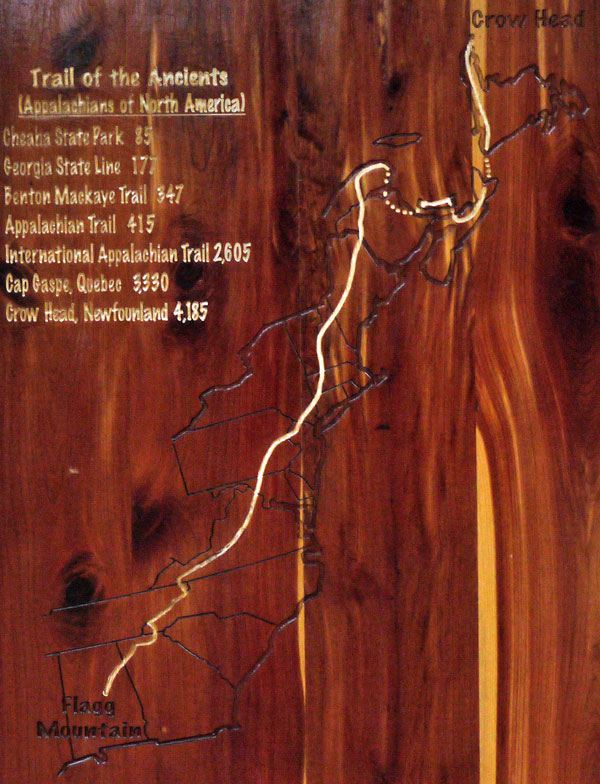 Trail of the Ancients Varnished Carved Wood Map Photo taken by Dan Bedore 30 March 2020. |
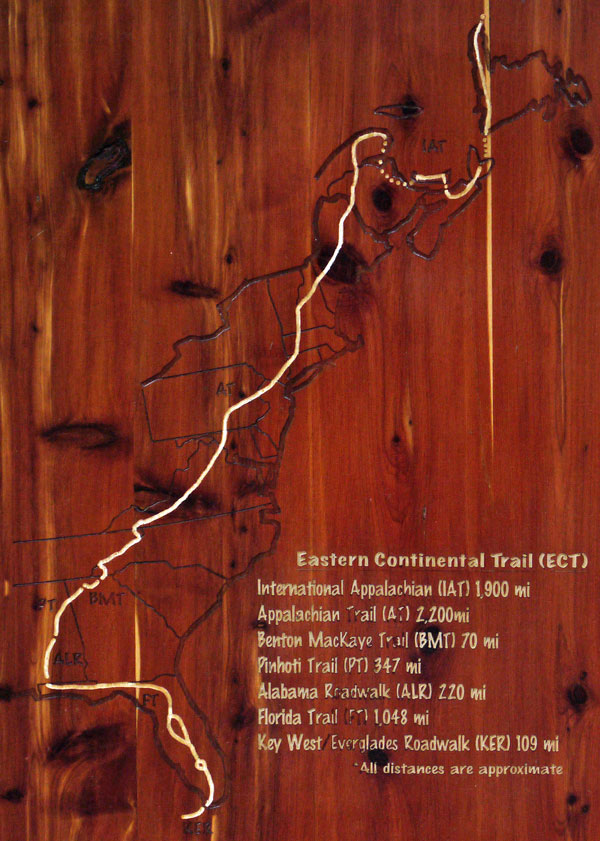 Eastern Continental Trail Varnished Carved Wood Map Photo taken by Dan Bedore 30 March 2020. |
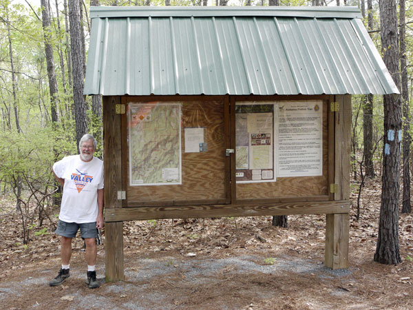 Plastic Windowed Kiosk for Maps and Notices Photo taken by Dan Bedore 30 March 2020. |
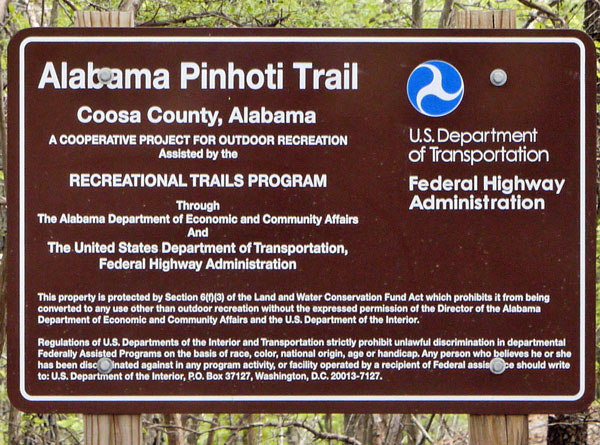 Sign Detail Photo taken by Dan Bedore 30 March 2020. |
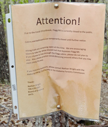 Covid-19 Flagg Closure Notice Photo taken by Dan Bedore 30 March 2020. |
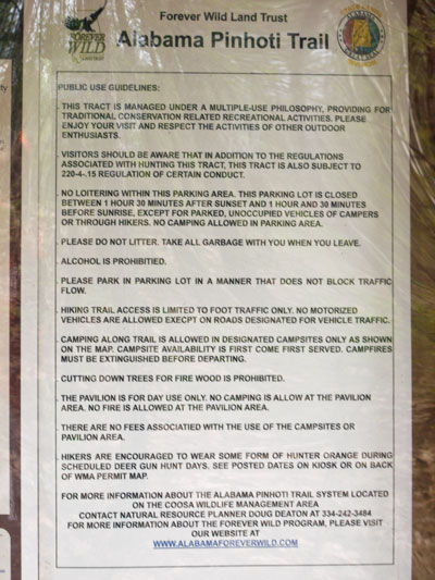 Alabama Forever Wild Rules Notice Photo taken by Dan Bedore 30 March 2020. |
|
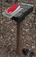
Podium where the Log Book is Kept. Photo taken by Dan Bedore 30 March 2020. Located north along the trail between the Picnic Pavilion and the Trail Y pictured below, closer to the Y. 32.973205°N, -86.348645°W |
|
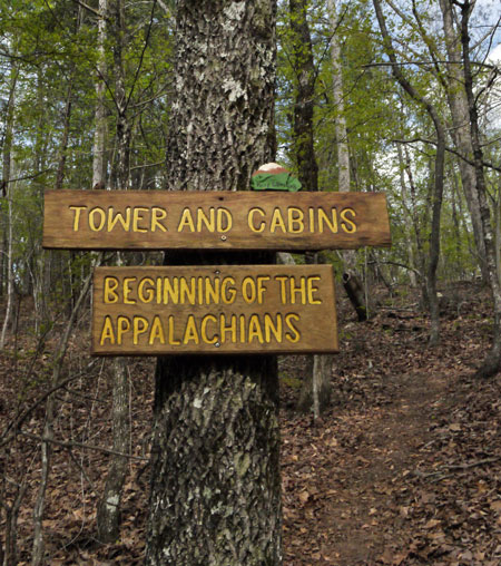 Signs at Y in Trail Photo taken by Dan Bedore 30 March 2020. |
|
Trail branching to top of Flagg to the right of the tree. Located a few minutes north along the trail from the Picnic Pavilion Terminus, beyond the Logbook Podium. Painted rock says "Keep Climbing." 32.973721°N, -86.348555°W |
|
Notes: I should get more photos of the general area, the details of the shelter and table, the back of the windowed kiosk, the ECT / TotA Kiosk. I should make recommendations for avoiding cruddy looking temporary notices by either placing them in the weatherproof Kiosk, or carving them in 2x4 stock. Who has the Kiosk Key? Such temporary notices could be nailed up with small nails, and pulled out by hand and detroyed when no longer needed. The ziplock notice looks cruddy, and may encourage posting of other junk, vandalism, etcetera. |