
Kiosk South of Road 148
Photo taken by Dan Bedore 4 April 2020.
|
This page discusses facilities located from the Bull's Gap 148 northbound to Porter Gap 77. |
|
Kiosk South of Road 148 Photo taken by Dan Bedore 4 April 2020. |

Bull Gap Looking South, New Kiosk
January 2012
In fall of 2018, we still need to build a decent set of stairs at
Bull Gap to replace these decrepit stepping stones up the 8' road embankment.
Photo by John Calhoun
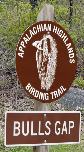 Birding Trail Sign Photo taken by Dan Bedore 4 April 2020. According to https://alabamabirdingtrails.com/ Bull’s Gap is a good place to see migrants in spring and fall, and some breeding birds: Scarlet Tanagers, Black-throated Green Warblers, Ovenbirds, Worm-eating Warblers, Brown-headed Nuthatches, Pileated and Hairy Woodpeckers. September - November, there are hawk; the views are good for soaring birds. |
 Bull's Gap Parking Photo taken by Dan Bedore 4 April 2020. |
| Left to right: Several cars can park in a gravel hardened pull out. A double blue blaze indicates the northbound Pinhoti turns and ascends the slope to the right beyond the Kiosk. The view below is taken from a rock to the right of the curve in the road, beyond the cyclists. The road continues to busy dispersed camps. The kiosk is for the State Game Hollins Wildlife Management area. (The Pinhoti Kiosk above is across 148.) Finally, the FR607 road sign. |

Trash at Bull Gap / FR675
February 10, 2014
Photo by John Calhoun
 Hollins WMA Kiosk Photo taken by Dan Bedore 4 April 2020. |
 View Southwest from Bull's Gap Photo taken by Dan Bedore 4 April 2020. |
 Water Cache Photo taken by Dan Bedore 4 April 2020. |
 Power Line West Photo taken by Dan Bedore 4 April 2020. |
| Solo proposes a shelter nearby. |
 Solo: High Tension Power Line Photo taken by Dan Bedore 4 April 2020. 33.263438°N, -86.084667°W |
 View East from High Tension Power Line Photo taken by Dan Bedore 4 April 2020. 33.263438°N, -86.084667°W |
 View West from High Tension Power Line Photo taken by Dan Bedore 4 April 2020. 33.263438°N, -86.084667°W |
 Randall D. Heath Cross Photo taken by Dan Bedore 4 April 2020. D.O.B. Dec. 21st. 1956 ASHES TO ASHES Randall D. Heath D.O.D Feb. 5th. 2001 33.274915°N, -86.085862°W |
 View West from Heath Monument Photo taken by Dan Bedore 4 April 2020. 33.274915°N, -86.085862°W |

Tom on Horn Mountain. The deer stand has since been removed.
January 2012
Photo by John Calhoun
 Tires dumped on Horn Mountain Photo taken by John Calhoun 16 December 2009. °N, °W |
 Tires dumped on Horn Mountain Photo taken by John Calhoun 16 December 2009. °N, °W |
 Tires dumped on Horn Mountain Photo taken by John Calhoun 16 December 2009. °N, °W |
 Porter Gap Kiosk Photo taken by Dan Bedore 5 April 2020. |
 Porter Gap Kiosk Photo taken by Dan Bedore 5 April 2020. |
 Porter Gap Kiosk Photo taken by Dan Bedore 5 April 2020. |
| Bullet holes in front, latches in back. | |