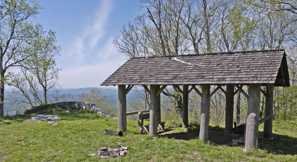
Horn Mountain Rebuilt Picnic Shelter
Photo taken by Dan Bedore 4 April 2020.
33.298157°N, -86.074497°W
|
This page discusses the CCC Picnic Area, Fire Tower, and other facilities at Horn Mountain, just east of the Pinhoti Trail. |
|
From a John Calhoun Daily Report: Pinhoti Trail Mtce., Bull Gap AL Hwy 148 n & S. May 7, 23, & 29th, 2017. I used loppers to clear the trail north for about 0.3 mile and also cleared south for about 0.1 mile. While I was on the south side I met Tracy Horne and his son, backpacking. Tracy said that Horn Mt got its name from his grandfather!!!! I also cleared the trash & brush at Trammell TH and picked up litter at Porter Gap TH too. Total time 18.3 hrs., drive time 6.3 hrs., 332 miles, 0.4 miles of trail cleared. 3 trips. |
 Horn Mountain Rebuilt Picnic Shelter Photo taken by Dan Bedore 4 April 2020. 33.298157°N, -86.074497°W |
| The shelter is in generally good shape, but an aluminum strip is tearing out from under the upper row of shingles. A fire ring is in the mowed grass area, and a half burnt log by a shelter pillar. The northern pulpit for the view west is shown, and some of the western view. |
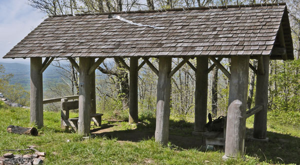 Horn Mountain Rebuilt Picnic Shelter Photo taken by Dan Bedore 4 April 2020. 33.298157°N, -86.074497°W |
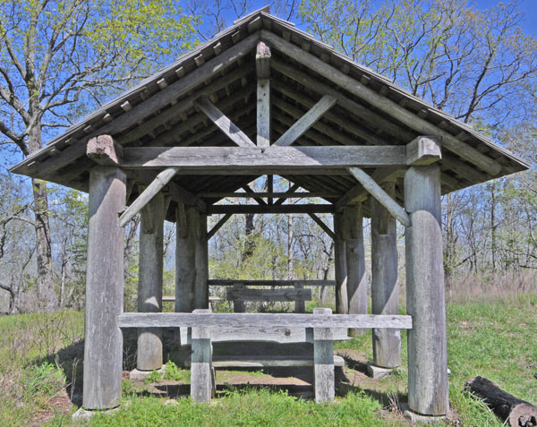 Horn Mountain Rebuilt Picnic Shelter Photo taken by Dan Bedore 4 April 2020. 33.298157°N, -86.074497°W |
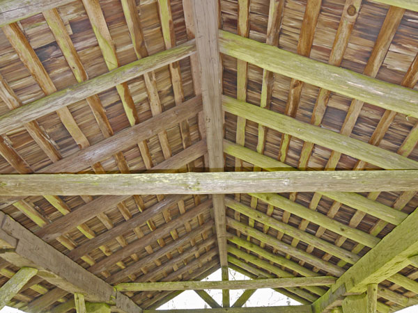 Horn Mountain Rebuilt Picnic Shelter Photo taken by Dan Bedore 4 April 2020. 33.298157°N, -86.074497°W |
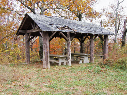
Horn Mountain Picnic Shelter before volunteer rebuild
Thursday, November 3, 2005
Photo by John Calhoun
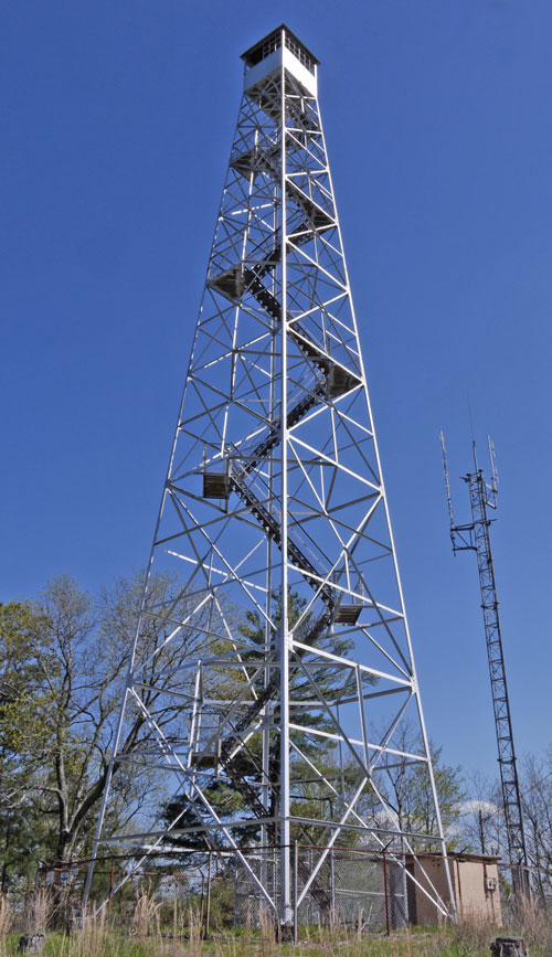 Horn Mountain Fire Tower Photo taken by Dan Bedore 4 April 2020. 33.297895°N, -86.074652°W |
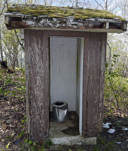 Horn Mountain Chamber Toilet Photo taken by Dan Bedore 4 April 2020. 33.298261°N, -86.074341°W ? |
| Vandalized, weathered, and unmaintained, but useable by those with their own toilet paper. |
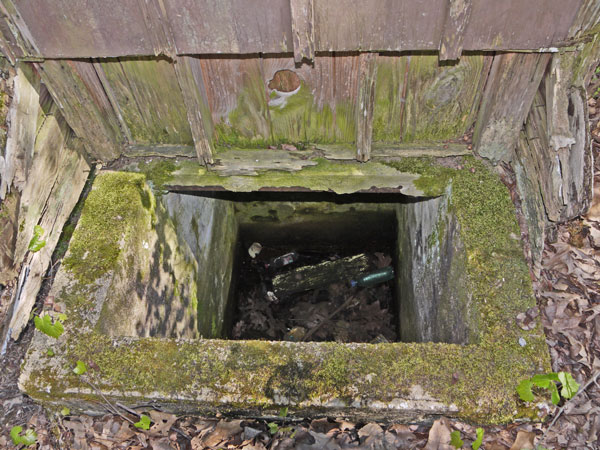 Horn Mountain Toilet Chamber Photo taken by Dan Bedore 4 April 2020. 33.298261°N, -86.074341°W ? |
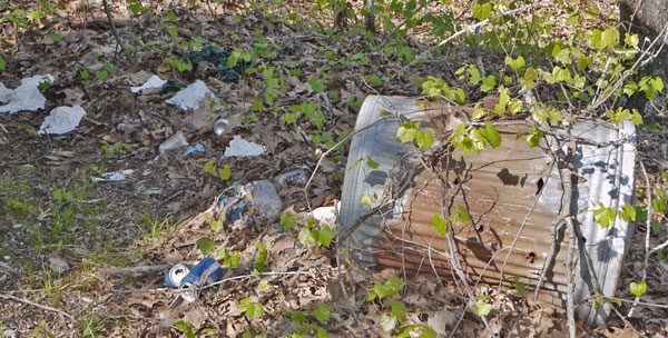 Horn Mountain Trash Photo taken by Dan Bedore 4 April 2020. 33.298261°N, -86.074341°W ? |
| By the toilet. This trash can ought to be removed so people are not tempted to leave trash atop Horn Mountain. Since the can is never emptied, it will eventually be tipped, and the garbage will spread like shown here. |
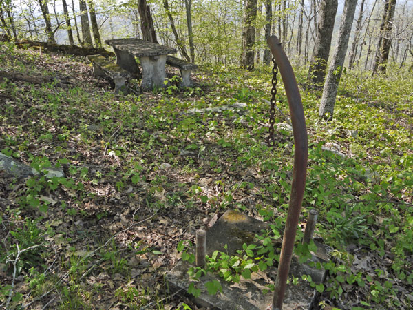 Table and Trash Can Holder Photo taken by Dan Bedore 4 April 2020. °N, °W ? |
| Roughly west of the toilet and north of the picnic shelter. |
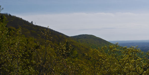 Horn Mountain Fire Tower Photo taken by Dan Bedore 4 April 2020. 33.297895°N, -86.074652°W |
| Taken from the Pinhoti Trail about an hour's walk north of Horn Mountain. The tower is about ¼ of the width of the picture from the left edge. |
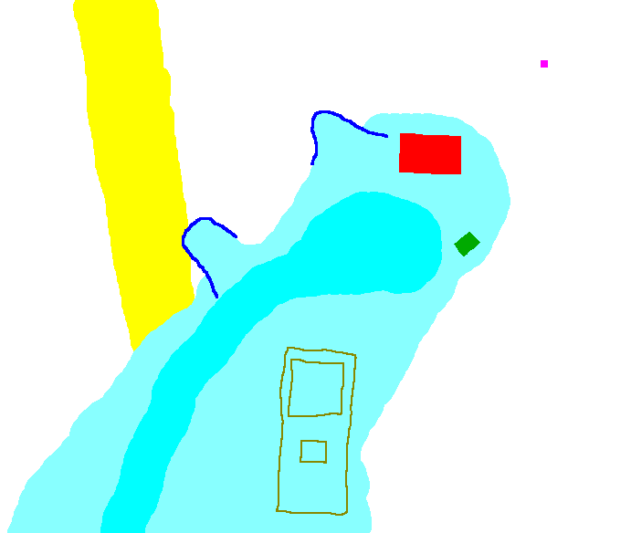 Horn Mountain Structures Map Made by Dan Bedore 25 July 2020. 33.298157°N, -86.074497°W Picnic Shelter, Red |
| I developed this struture location map and Latitude / Longitude locations below from a Google Map Satelite Image. In yellow is the Power Line Cut most Pinhoti hikers might use to ascend from the trail to the peak. Occasionally Pinhoti Trail Crews clear a path, but brush grows quicky, and power line easment maintenance crews toss cut branches into the cleared space. Other trails have been cleared to the top, and more are always being considered, but without regular use and maintenance, they disappear. In dark blue are pulpits for enjoying the view to the west, level soil areas surrounded by low stone walls. The light blue area is cleared of trees and sometimes mowed, the slighly darker area is where cars have made tracks. In olive is the fire lookout tower, the fence around it, and the electronics shed. In Green is a picnic table in the parking lot. In red is the Picnic Shelter. In purple is the toilet, I think. (It's not very clear in the satelite image.) Another table and trash can holder is roughly west of the toilet, and north of the shelter, invisible in the satelite photo. |
|
33.297895°N, -86.0746527°W Fire Tower 33.298061°N, -86.0744447°W Table in Lot 33.298261°N, -86.0743417°W Toilet? 33.298157°N, -86.0744970°W Picnic Shelter |
 Photo taken by Dan Bedore 4 April 2020. °N, °W |